Unusually warm weather has made its way into the northern regions of the Midwest and Great Lakes regions this week. With that, the possibility of severe weather has made an earlier than usual appearance into the area. The Storm Prediction Center has issued a slight risk (level 2/5) for severe weather for the Bowling Green area tomorrow, February 27th. There is a risk for all severe hazards tomorrow evening into the early nighttime hours. Damaging winds and hail are currently the primary threats for the possible severe weather event however, a tornado or two cannot be ruled out. Now is the right time to review a severe weather safety plan. It is better to be prepared for severe weather and have the severe weather never occur rather than be caught off guard. Review your tornado safe spot in your home, apartment, or dormitory. The lowest level of your home or building is the safest place to be during a tornado warning. You also want to be in the most interior part of the lowest level away from windows as well. Make sure you stay alert for any warnings from the National Weather Service in Cleveland. You can stay updated on the developing weather situation through BG Falcon Media social media and the National Weather Service in Cleveland’s social media.
Categories:
Severe Weather Possible Tomorrow
February 26, 2024
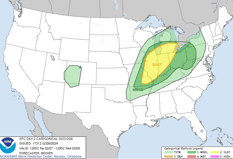
Day 2 Severe Weather Outlook from the Storm Prediction Center from February 2, 2024 at 3:50 PM.
Donate to BG Falcon Media
$1175
$2500
Contributed
Our Goal
Your donation will support the student journalists of Bowling Green State University. Your contribution will allow us to purchase equipment and cover our annual website hosting costs.
More to Discover